A building may look straightforward on an architectural drawing, but its actual geometry often tells a different story. Walls are not always perfectly aligned, installations may have been modified over the years, and the available documentation may no longer reflect what exists on site. These differences become particularly important when planning renovation, industrial upgrades or new construction work.
3D scanning provides a detailed digital record of existing spaces and structures. By capturing millions of spatial measurements, it creates a reliable geometric reference for architects, engineers, construction companies and facility managers. Instead of working exclusively with outdated plans or isolated measurements, project teams can base their decisions on information collected directly from the physical environment.
What Is 3D Scanning and How Does It Work?
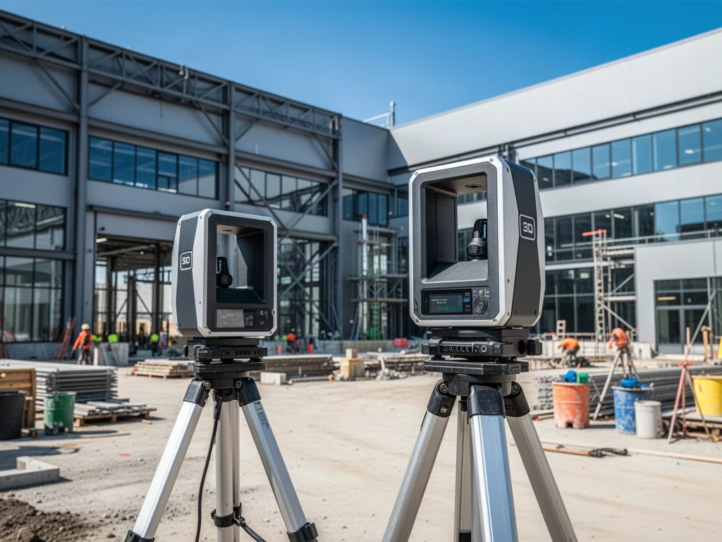
3D laser scanning is a surveying technology that measures the position of visible surfaces in three-dimensional space. A laser scanner records distances and angles, producing a collection of spatial coordinates known as a point cloud.
Each point represents a measured location on an object or surface. When data from multiple scanner positions is combined, the result is a digital representation of the scanned environment.
Depending on the project requirements, this information can be used to develop floor plans, building sections, elevation drawings or three-dimensional models.
A point cloud is not necessarily a finished CAD or BIM model. It is the underlying measurement dataset from which additional documentation can be created. Understanding this distinction is essential when defining the scope of a scanning project.
For complex buildings and industrial installations, scanning can also be combined with conventional surveying and drone photogrammetry to obtain information from different perspectives.
Why Accurate Existing-Condition Data Matters
Designing modifications to an existing facility requires a reliable understanding of its current geometry. Even relatively small discrepancies between drawings and reality can complicate the installation of new equipment or the preparation of construction documentation.
Consider a production facility where new machinery must be installed between existing structural elements and service lines. The design team needs to understand not only the dimensions of the available floor space but also the positions of columns, pipes, overhead systems and other potential obstructions.
A 3D survey helps document these relationships before detailed design begins.
The same principle applies to office renovations, building extensions and architectural restoration. Reliable measurement data allows specialists to investigate spatial constraints before committing to specific design solutions.
It does not eliminate every technical uncertainty. Hidden installations, inaccessible areas and structural conditions may still require additional investigation.
Key Applications of 3D Scanning
Architectural Surveys and Building Renovation
Existing buildings frequently require updated documentation before substantial alterations can be designed.
Laser scanning can support the preparation of floor plans, elevations and sections based on measured conditions.
This is especially valuable when historical drawings are incomplete, inconsistent or unavailable.
For older properties, the recorded geometry may reveal irregularities that are difficult to capture through simplified manual measurements.
Industrial Facilities and Equipment Upgrades
Industrial environments contain complex relationships between structures, machinery, pipes and technical installations.
Scanning provides a spatial record that engineers can use when evaluating equipment placement, planning modifications or developing models of existing installations.
The resulting information can also support preliminary assessments of potential clashes between existing structures and proposed components.
Where equipment has restricted access or must remain operational, the surveying method and site schedule should be agreed upon before work begins.
As-Built Verification
Construction does not always reproduce the original design geometry exactly.
Comparing measured conditions with the design model can help identify geometric deviations and assess their relevance to later project stages.
Such comparisons may be presented as deviation maps, allowing project teams to focus on areas that require further examination.
Heritage and Complex Structures
Buildings with intricate details, irregular surfaces and nonstandard construction features can be difficult to document using conventional drawings alone.
3D scanning provides detailed spatial data that may support architectural inventory, restoration planning and the preparation of technical documentation.
However, laser scanning records visible geometry rather than the internal condition of materials. Specialist inspections remain necessary when structural performance or material degradation must be evaluated.
From Point Clouds to CAD Drawings and BIM Models
One of the most useful aspects of reality capture is the possibility of transforming measurement data into practical design information.
A project may require a registered point cloud, traditional 2D drawings, a geometric 3D model or an information-rich BIM model. These deliverables serve different purposes.
A registered point cloud preserves the observed geometry and can be used as a reference for further work. CAD drawings present selected features in a format suitable for conventional documentation. A BIM model can organize modeled building elements and associated information according to an agreed specification.
The appropriate output depends on how the client intends to use it.
For example, an architect preparing a simple interior refurbishment may need floor plans and sections. An engineering team planning a complicated plant modification may benefit from a coordinated three-dimensional model.
Requesting an unnecessarily detailed deliverable can increase modeling work without creating meaningful value for the project.
Choosing Between Laser Scanning and Drone Photogrammetry
Although both technologies are used for spatial documentation, they are not interchangeable.
Terrestrial laser scanning is particularly useful for interiors, building details, complex installations and environments where dense geometric measurements are needed.
Drone photogrammetry uses overlapping aerial photographs to reconstruct spatial information. It can be useful for roofs, façades, terrain and large outdoor sites, provided flight and visibility conditions permit.
Combining methods can provide more complete coverage than either technology alone.
The final selection should reflect the size of the site, required accuracy, accessibility, potential obstructions and the intended deliverables.
PKIG – Integrated 3D Measurement Services
PKIG provides 3D scanning, architectural documentation, drone surveys, as-built measurements, industrial 3D scanning and BIM-related modeling services.
The company’s service range makes it possible to address different measurement requirements within a coordinated project scope, from recording the existing conditions of a building to preparing documentation for further design work.
PKIG also works with drone photogrammetry, which may complement terrestrial scanning when external structures, roofs or extensive sites must be documented.
The main objective is to select the appropriate measurement method and resulting documentation for the client’s actual technical requirements.
What Should Be Agreed Before Commissioning a 3D Survey?
A useful project brief should identify the location and type of facility, approximate size of the area, accessibility restrictions, intended use of the data and required outputs.
Accuracy requirements should be defined in relation to the engineering task rather than assumed from the scanning technology alone.
It is equally important to establish whether the client requires raw measurement data, a registered point cloud, CAD drawings or a BIM model.
The scope should also clarify whether invisible or inaccessible elements need separate verification.
Providing this information at the beginning helps the surveying team propose an appropriate methodology and estimate the resources required.
Turning Physical Spaces into Useful Digital Information
3D scanning is not simply a way to create an impressive visual model. Its practical value lies in providing structured geometric information that engineers and designers can use to understand existing conditions.
For renovation projects, industrial modernization and building documentation, the technology can establish a more reliable starting point for technical decisions.
Organizations considering laser scanning, architectural inventories or drone-assisted measurements can explore PKIG’s services and discuss which documentation format best fits their project.
Artykuł sponsorowany

